JOIN GEOSHARE
Boliden Aitik Tailings Storage Monitoring, Sweden
Aitik Tailings Storage Facility (TSF) is located about 15km southeast of Gällivare, Sweden. Mining began in 1968, and Aitik has grown into one of Europe’s largest copper mines, with a permitted capacity of 45 million tonnes per year.It operates as an open-pit mine, where ore is processed on-site into a mineral concentrate. This is transported by rail to the Rönnskär smelters, while waste rock and tailings are deposited locally.
Boliden has committed to the Global Industry Standard on Tailings Management (GISTM), a global benchmark for safe, responsible tailings management, aiming for zero harm and launched a remediation program at the mine.
Between 2020 and 2024, over 45 million tonnes of rockfill were placed to buttress key embankments. The works included the installation of shear keys and toe berms to enhance long-term dam stability. Crucially, Boliden also transitioned the dam construction method from Upstream to Downstream configuration— improving safety without interrupting ongoing operations.
Project Summary
- Name
- Boliden Aitik Tailings Storage Monitoring, Sweden
- Location
- Aitik, Sweden
- Date
- 2024
- Client
- Boliden Minerals AB
- Instrumentation Specialist
- Ruspeco
- Consultant
- Klohn Crippen Berger (KCB)

Tailings Storage Monitoring
The Aitik Tailings Storage Facility (TSF) is divided into multiple embankments, including dams A–B, C–D, E–F, G–H, and I–J. HS, VR and V2. A monitoring program by Ruspeco supports ongoing risk mitigation across the site. Key monitoring objectives include:
- Tracking pore pressure in dams and foundations
- Detecting seepage and internal erosion
- Measuring embankment deformation and lateral movement
Three different types of Geosense Piezometer were used to monitor pore water pressures in critical zones in the Tailings Dam and Foundations. They were part of the Trigger Action Response Plan (TARP) for a near-real-time response for the higher-risk areas like dam E–F, where pore pressure increases may indicate instability. Standard VW-3000 & 3400 Drive-in version Piezometers were used plus other Piezometers to automate legacy sensors.
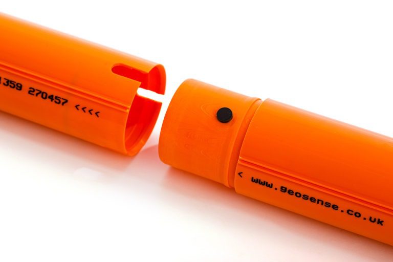
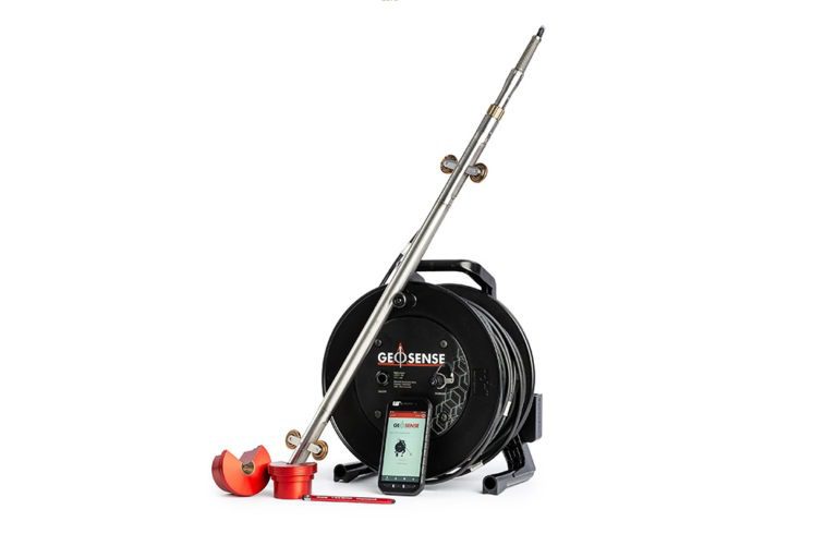
For the embankment areas, Geosense In-place Inclinometers (IPI) were installed in Quick-joint casing to measure any lateral displacement in the ground. An additional Geosense Portable Inclinometer system is also in use for spot measurements on some parts of the mine site.
The instrumentation is all compatible and connected to a series of Worldsensing gateways and loggers, enabling automated data collection and reducing the need for cabling across the vast site. Visualization and analysis are performed in real-time using Bentley VDV software, ensuring continued GISTM compliance.